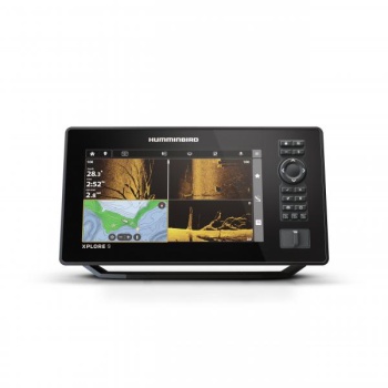
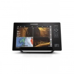
Kajalood & GPS Humminbird XPLORE 9" CHO (ilma andurita) (2025a mudel)
Kaubamärk: Humminbird
Ühik: tk
Laoseis kaupluses: Kauplusest otsas, juhul kui saab lisada ostukorvi tellitakse tarnija laost
Tarneaeg: Eeltelli, küsi täpsemat tarneaega
Video
Humminbird XPLORE seeria kajaloodid on loodud pakkuma kalastajatele tipptasemel tehnoloogiat ja kasutusmugavust. Nende seadmetega leiate kalastuspaigad kiiremini, kasutades sisseehitatud LakeMaster ja CoastMaster kaarte, ning saate sünkroonida kuni 10 000 kalastuskohta oma nutitelefoniga, kasutades uut teekonnapunktide haldussüsteemi. Lisaks on XPLORE kajaloodid ühilduvad MEGA Live 2 ettevaatava sonariga, mis pakub reaalajas selget pilti paadi all toimuvast.
Humminbird XPLORE CHO (Control Head Only) – kalaleidja ilma andurita
Humminbird XPLORE CHO on täiuslik valik kalastajatele, kes soovivad ühenduda sisseehitatud MEGA Imaging'uga Minn Kota trolling-mootoritel, kasutada täiendavaid anduri valikuid, nagu MEGA 360 Imaging, või jagada sonariandmeid olemasolevast Humminbirdi Etherneti võrgust. See mudel pakub paindlikkust ja lihtsat ühenduvust, olles ideaalne valik neile, kes juba omavad sobivaid andureid või tahavad ehitada professionaalset kalapüügivõrgustikku.
Peamised omadused:
-
Täis-HD ekraan koos Cross Touch® liidesega: XPLORE kajaloodidel on 1280H x 720V resolutsiooniga ekraan, mis kuvab detailseid sonari- ja kaardipilte. Seadet saab juhtida nii puuteekraani kui ka nuppude abil.
-
MEGA Side Imaging+: Pakub kristallselget külgvaadet kuni 61 meetri kaugusele mõlemal pool paati, võimaldades avastada rohkem kalu ja struktuure.
-
MEGA Down Imaging+: Tagab erakordse allavaate selguse kuni 61 meetri sügavusele, aidates tuvastada kalu ja põhjastruktuure.
-
Dual Spectrum CHIRP sonar: Pakub kõrge eraldusvõimega kalakaarte ja selget vaadet põhjastruktuuridele. Valikus on lai režiim maksimaalse katvuse jaoks ja kitsas režiim detailide täpseks tuvastamiseks.
-
Sisseehitatud GPS ja Humminbird Basemap: Täpne GPS koos eelinstallitud kaartidega üle 10 000 järve ning rannikualade katvusega USA-s ja Kanadas, võimaldades navigeerida enesekindlalt.
-
Premium kaartide tugi: Ühilduvus LakeMaster® ja CoastMaster™ kaartidega, samuti Navionics® kaartidega, pakub täielikku ülevaadet veealusest maailmast.
-
AutoChart Live: Looge reaalajas kaarte oma kalastuskohtadest, salvestades sügavuskontuure, põhja kõvadust ja taimestikku. Seade võimaldab kuni 8 tundi sisemist salvestusaega, laiendatav AutoChart Zero Line SD kaartidega.
-
One-Boat Network ühilduvus: Integreerub sujuvalt Minn Kota ja Cannon toodetega, võimaldades paadi ja kalapüügi funktsioonide täielikku juhtimist.
-
Etherneti võrgustik: Kiire Ethernet-ühendus võimaldab ühendada mitu kajaloodi ja lisaseadmeid, nagu Minn Kota i-Pilot Link ja Humminbird CHIRP Radar.
-
Bluetooth: Juhtmevaba ühendus võimaldab juhtida Talon ja Raptor madala vee ankrusüsteeme ning Cannon Optimum downrigger'eid otse kajaloodi ekraanilt. Lisaks toetab see tarkvarauuendusi ja nutitelefoni teavituste kuvamist.
-
NMEA 2000 võrgustiku tugi: Ühendage NMEA 2000 võrgustik, et saada lisainfot paadi jõudluse, ilma ja veeolude kohta.
Tehnilised andmed (XPLORE 9 CMSI+):
-
Ekraani suurus: 9 tolli (diagonaal)
-
Ekraani resolutsioon: 1280 x 720 pikslit
-
Mälu kaardipesad: Kaks Micro SD pesa
-
Sonar: Dual Spectrum CHIRP, MEGA Side Imaging+, MEGA Down Imaging+
-
Sonari sagedused: 50/83/200/455/800 kHz, HW DSC CHIRP, ja MEGA
-
Maksimaalne sügavus: 1 067 meetrit (valikulise 50 kHz anduriga), 365 meetrit (standardsensori puhul)
-
Külgvaate ulatus: 244 meetrit (455 kHz), 122 meetrit (MEGA)
-
Toitepinge: 10,8–20 VDC
-
Toite väljund (RMS): 1000 vatti
-
GPS: Sisseehitatud
-
Teekonnapunktid, marsruudid, jäljed/punktid: 10 000, 50, 50/20 000
-
NMEA 2000 tugi: Sisseehitatud
-
Garantii: 2 aastat
XPLORE seeria kajaloodid pakuvad kalastajatele kõike vajalikku, et leida kalu kiiremini ja tõhusamalt, pakkudes samal ajal kasutajasõbralikku liidest ja tipptasemel tehnoloogiat.
The XPLORE Series is lightning-quick and laser-focused on anglers’ favorite features. Find your fishing spots faster with included LakeMaster and CoastMaster charts. Sync 10,000 fish spots with custom colors and icons to your phone through a new waypoint management system. Get the clearest picture of what’s below with compatibility for our best sonar, including MEGA Live 2 forward-facing sonar. Connects to Minn Kota products and control them on command – from enabling Advanced GPS navigation to deploying shallow water anchors – with One Boat Network compatibility. With our most advanced technologies and easy-to-use interface, there’s more to XPLORE.
Full-HD Display with Cross Touch® interface: XPLORE delivers eye-popping detail with a 1280H x 720V display. See the incredible detail of sonar and chart images that will ensure you never miss a thing. Control it all using the touchscreen or the keypad—it's up to you.
MEGA Side Imaging+: See the world below like never before with a crystal-clear Side Imaging viewing out to 200 feet on either side of your boat. You'll unlock more fish and structure with 20% more detail and 60% more range capability than MEGA Side Imaging sonar.
MEGA Down Imaging+: Get unprecedented underwater clarity with Down Imaging coverage down to 200 feet below your boat. You'll unlock more fish and structure with 20% more detail and 60% more depth capability than MEGA Down Imaging sonar.
Dual Spectrum CHIRP Sonar: Before you cast, know what's down there thanks to highly-detailed fish arches and a clear view of fish-holding structure and the bottom. Powered by our proprietary, Low-Q CHIRP transducer, Dual Spectrum offers two ways to search; Wide Mode for maximum coverage and Narrow Mode for focusing on the slightest detail.
Internal GPS and Humminbird Basemap: Our enhanced basemap provides you with a clear view of underwater terrain and surrounding points of interest so you can fish and navigate with total confidence. Identify buoys, day markers, hazards, marinas, contours, depth markers and much, much more. Includes charts of more than 10,000 lakes, plus coastal coverage for the continental U.S.
Premium Chart Compatible: Humminbird provides the most complete offering of premium chart options to anglers everywhere. Get a complete view of the world below with optional charts from Humminbird's LakeMaster® and CoastMaster™ products, as well as your choice of compatible Navionics® charts.
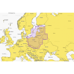
Includes LakeMaster and CoastMaster VX map card with U.S. and Canada regions standard data.
AutoChart Live: Create real-time maps of your fishing spots, with access to patented Humminbird® LakeMaster® features. Map depth contours, bottom hardness and vegetation as you drive your boat. Comes standard with eight (8) hours of built-in recording time and is compatible with AutoChart Zero Line SD cards for virtually endless AutoChart Live mapping capacity.
One-Boat Network Compatible: Many Humminbird models seamlessly integrate and communicate with Minn Kota and Cannon products to unlock more features and capabilities for anglers everywhere. Make the most of your time on the water with the exclusive boat control and fish-catching features of the One-Boat Network.
Ethernet Networking: High-speed Ethernet allows you to build a powerful, professional-grade fishing system. Easily connect multiple fish finders, or upgrade to add-on technologies like Minn Kota i-Pilot Link and Humminbird CHIRP Radar.
Bluetooth: Take control right from the screen of your Humminbird with wireless communication to compatible Talon and Raptor shallow water anchors, as well as Cannon Optimum downriggers. Additional features include wireless software updates from the Humminbird One-Boat App and display of smartphone notifications on your Humminbird.
NMEA 2000 Networking Built-in: Connect an accessory NMEA 2000 network to your control head for even more information; from boat performance to weather and water conditions, make sense of it all with NMEA 2000 networking.
2-Year Limited Warranty
Model XPLORE 9 CHO Fish Finder
Product Code 412000-1CHO
Series XPLORE
UPC 0082324058660
Display Size - Diagonal 9 in
Display Pixel Matrix 1280 x 720
Transducer Included N/A
Compatible With Minn Kota US2 Sonar, Minn Kota Built-In MEGA DI, Minn Kota Talon/Raptor, Minn Kota i-Pilot Link, Minn Kota Built-In MEGA SI, MEGA Live, NMEA 2000, MEGA 360, Radar, AutoPilot, One-Boat Network
Features Touch Screen, Networking, Down Imaging, Built In GPS, Bluetooth, Side Imaging, Built In Mapping, MEGA Imaging+, Wi-Fi, MEGA Imaging
Memory Card Slot Dual Micro SD
Sonar-Standard Dual Spectrum CHIRP, MEGA Side Imaging+, MEGA Down Imaging+
Sonar-Optional 50/83/200 kHz, Airmar High, High Wide, Medium, Medium Wide, and Low
CHIRP - Frequencies Supported Narrow Mode (180-240 kHz), Wide Mode (140-200 kHz), Full Mode (150-220 kHz)
Sonar-Frequencies Supported 50/83/200/455/800 kHz, HW DSC CHIRP, and MEGA
Depth-Sonar 3,500 ft (optional 50 kHz), 1,200 ft (standard transducer)
CHIRP - Imaging Frequencies Supported 455 kHz SI+ (405-505 kHz), 455 kHz (420-520 kHz), MEGA SI+ (1050-1175 kHz)
Depth-Down Imaging 200 ft (MEGA), 400 ft (455 kHz)
Range-Side Imaging (Side-To-Side) 800 ft (455 kHz), 400 ft (MEGA)
Interface Touch Screen, Keypad Control
Power Input 10.8-20 VDC
Power Output Peak-to-Peak 8000 Watts
Power Output RMS 1000 Watts
Screen Snap Shot Included
Sonar Recording Included
Mount-Standard Gimbal
Mount-Standard Size 11.690 in W x 6.569 in H x 3.884 in D
Mount-Optional In-Dash Mounting Kit
Mount-Optional Size 6.259 in W x 11.69 in H x 3.3 in D
Transducer Mount Location Transom
GPS Chartplotting Included
GPS Receiver Internal
GPS Trackplotting Not Supported
Waypoints, Routes, Tracks/Points 10,000, 50, 50/20,000
360 Imaging Compatibility Yes
MEGA Live Compatibility Yes
Humminbird Basemap Included
LakeMaster Compatibility Yes
CoastMaster Compatibility Yes
Navionics Gold/HotMaps Compatibility Yes
Navionics Platinum+ Compatibility Yes
Platinum Compatibility Yes
Minn Kota Advanced GPS Navigation Compatibility Yes
Minn Kota i-Pilot Link Compatibility Yes
Minn Kota Talon Shallow Water Anchor Compatibility Yes
Radar Compatibility Yes
5-Port Ethernet Switch Compatibility Yes
AIS Compatibility Not Supported
Autopilot Compatibility No
Heading Sensor GPS Compatibility No
Heading Sensor GPS (NMEA 2000) Compatibility Yes
NMEA2000 Included
Target Separation 2.5 in
Upgradable Software Yes
View Preset Keys Yes
X-Press Menu System Yes
Custom Digital Readout Yes
Custom View Selections Yes
Display Colors Grayscale 24-Bit
Display Type Color TFT
Speed Included
Temperature Built In
Temperature Alarm Yes
Temperature Graph Yes
HDMI Compatible No
Warranty Two-Year Warranty
39,95 €
249,99 €
795,00 €
3395,00 €
95,95 €
